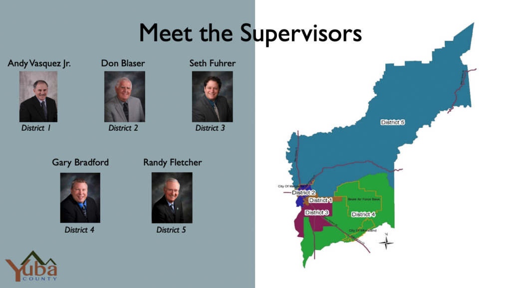
Current Districts and Supervisors
Using davesredistricting.org to Define Your Community of Interest
There are several prioritized criteria that Yuba County must use when drawing Supervisor District Boundaries. The first is population. Districts must be drawn so that there is no more than a 10% difference in population between the most populous district and the least populous district. Districts must be continuous. Assuming those conditions can be met, lines should be drawn so that the geographic integrity of local neighborhoods or communities shall be respected in a manner that minimizes its division.
That raises the question, what do you consider YOUR neighborhood or community? Is your “community of interest” defined by the city or unincorporated community where you live, for example, Plumas Lake or Wheatland? Or, is your “community of interest” smaller than that, maybe defined at the neighborhood level like Wheatland Ranch, Wheeler Ranch, Fairway Downs, or East Plumas Lake? Maybe your “community of interest” is a larger area that incorporates multiple neighborhoods like Camp Far West, North Plumas Lake, or Arboga. Finally, maybe your “community of interest” is a school district, school attendance boundary, reclamation district, fire district, or another special district?
As maps are drawn, the County wants to know what do you consider YOUR “community of interest”? You can email a written description to redistricting@co.yuba.ca.us but to really get your point across as precise as possible, consuming using a mapping tool such as davesredistricting.org.
To use that tool to map your “community of interest” follow these steps:
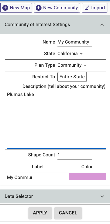
- Create an account and login at davesredistricting.org
- Click New Community in the upper right
- Give your community a Name, select California as the State, and provide a Description of your community.
- Click Apply
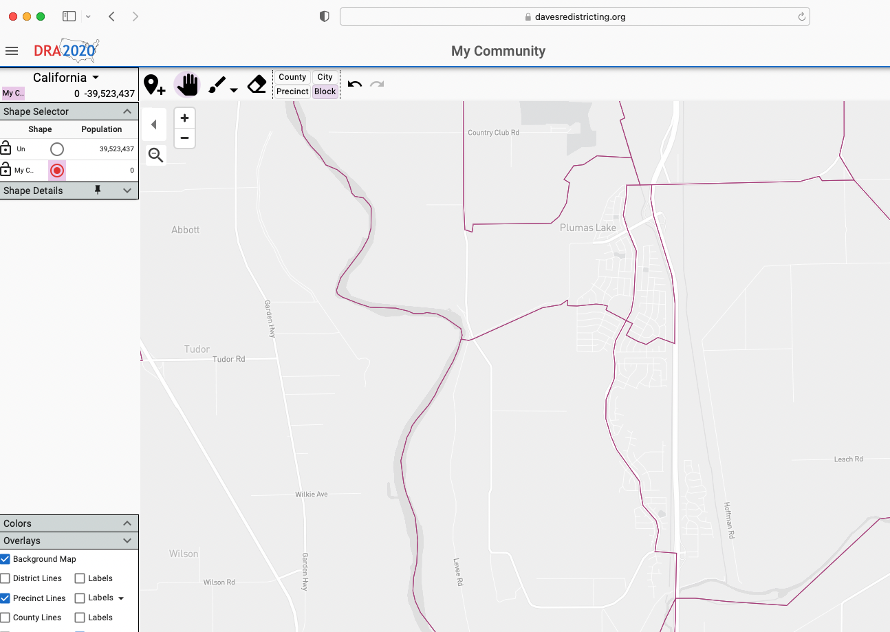
- Use the Navigation Tool (Hand) to find the portion of Yuba County where your “community of interest” is located.
- Select the Paint Tool (Paint Brush) and then click Block to start selecting census blocks that make up your “community of interest”
- Hover your mouse over the census tract (aka precinct) that contains blocks you want to select and then click to select it.
- Click the individual census blocks that make up your “community of interest”.
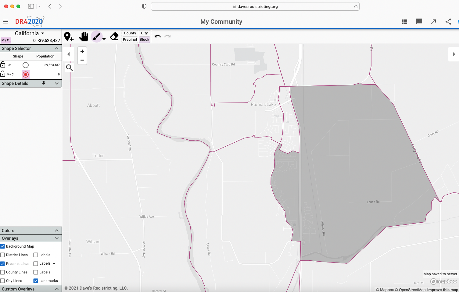
- Continue using the Navigation Tool (Hand) and Paint Tool (Paint Brush) to move around, zoom in/out, and select all the census blocks in your “community of interest”. If you want to remove a block from your “community of interest”, use the Erase tool.
- Once you have completed your map, do one of the following and email to redistricting@co.yuba.ca.us with a description of your “community of interest”
- Take a screenshot and attach it to your email
- Use the Export Map (arrow icon) function in the upper right of the screen to save the map as a PNG and attach it to your email.
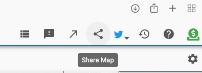
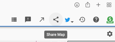
- Use the Share Map (thee dots connect by lines icon) function in the upper right of the screen to get a URL that you can copy/paste into your email.
A few screen shots of the steps listed above…

Using davesredistricting.org to Create a Draft Map
There are several prioritized criteria that Yuba County must use when drawing Supervisor District Boundaries. The first is population. Districts must be drawn so that there is no more than a 10% difference in population between the most populous district and the least populous district. Districts must be continuous. Assuming those conditions can be met, lines should be drawn so that the geographic integrity of local neighborhoods or communities shall be respected in a manner that minimizes its division.
That raises the question, how do you think the County should be split into 5 districts, each with a roughly equal population, keeping communities together as much as possible? You can create your own draft map and submit it to redistricting@co.yuba.ca.us.
To use davesredistricting.org to draw a draft map of all 5 supervisor districts, follow these steps:
- Create an account and login at davesredistricting.org
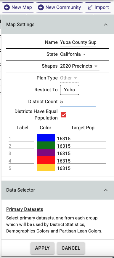
- Click New Map in the upper right
- Give your map a Name, select California as the State, select Other as the Plan Type, Restrict to Yuba, set District Count at 5, and ensure that “Districts Have Equal Population” is checked.
- Click Apply.
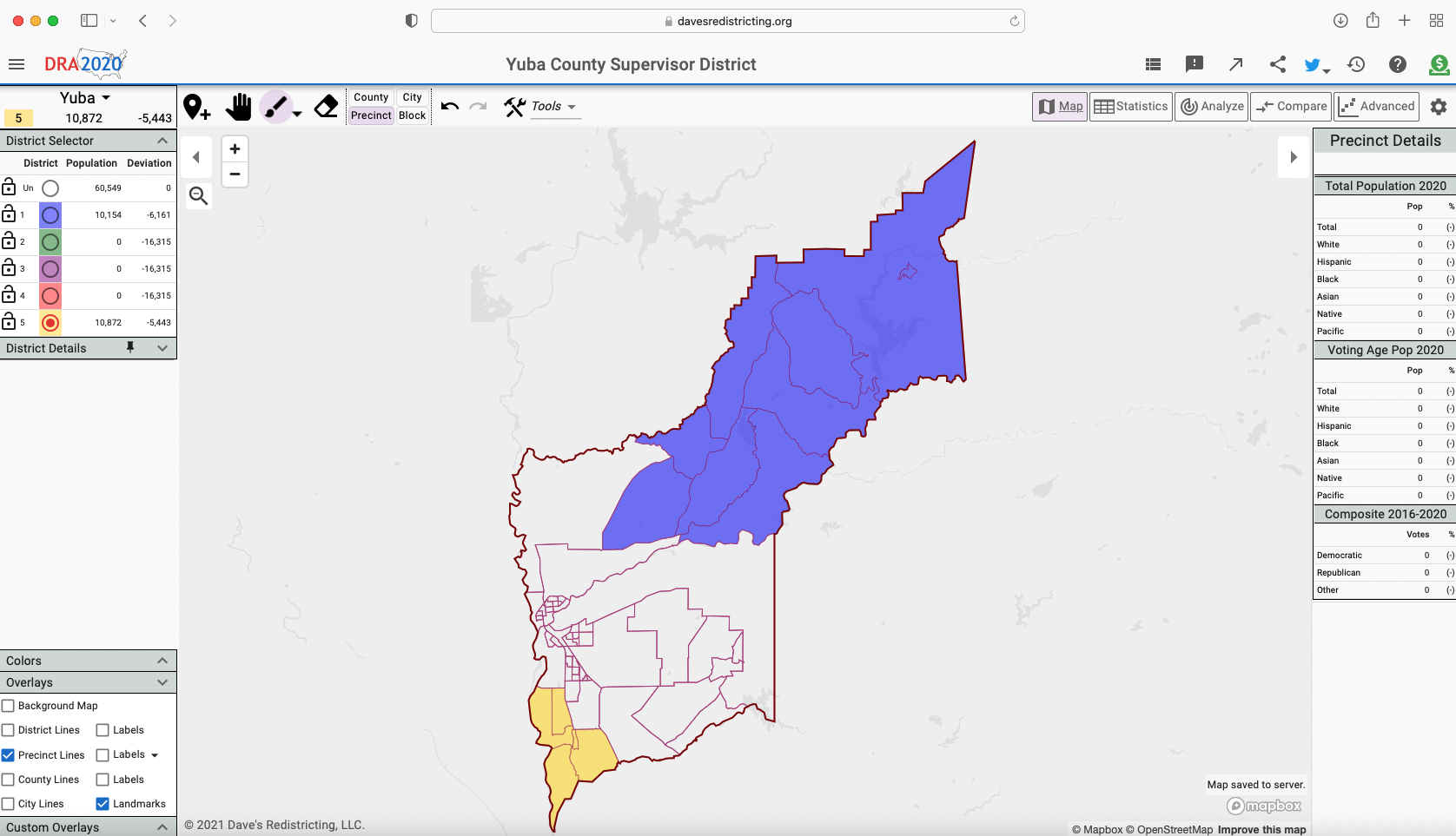
- Use the Navigation Tool (Hand) to find the portion of Yuba County where you want to start creating your first district.
- Select the District Number/Color in the District Selector that you want to work with
- Select the Paint Tool (Paint Brush) and then click Block to start selecting census blocks that make up your District.
- Continue using the Navigation Tool (Hand) and Paint Tool (Paint Brush) to move around, zoom in/out, and select all the census blocks you want to add to your District. If you want to remove a block from your District, use the Erase tool.
- Keep selecting census blocks until your District has a population of around 16,315.
- Repeat this process for the other 4 districts.
- Once you have completed your map, do one of the following and email to redistricting@co.yuba.ca.us with a description of your “community of interest”
- Take a screenshot and attach it to your email
- Use the Export Map (arrow icon) function in the upper right of the screen to save the map as a PNG and attach it to your email.
- Use the Share Map (thee dots connect by lines icon) function in the upper right of the screen to get a URL that you can copy/paste into your email.
A few screenshots of the steps listed above…