
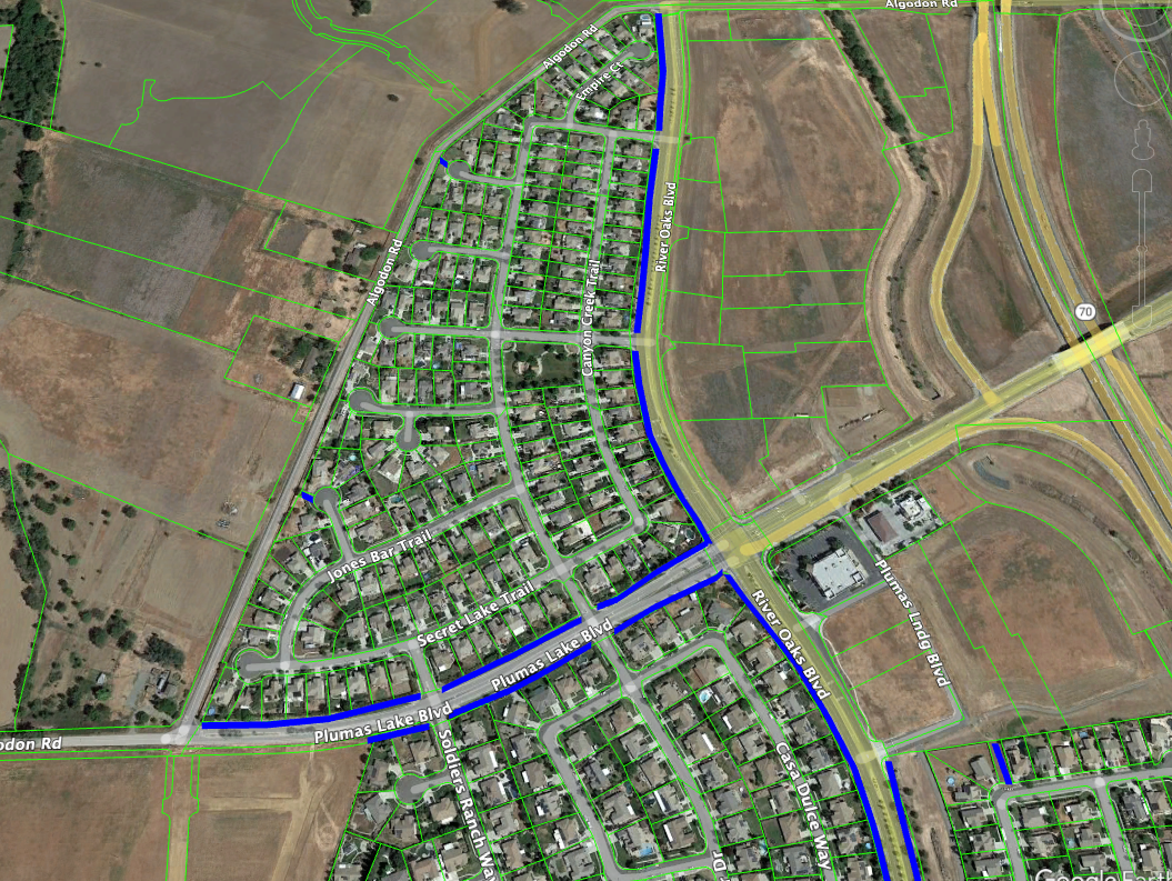
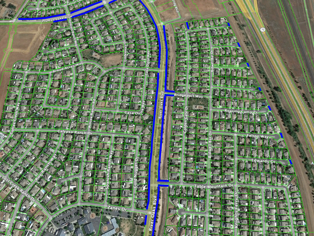
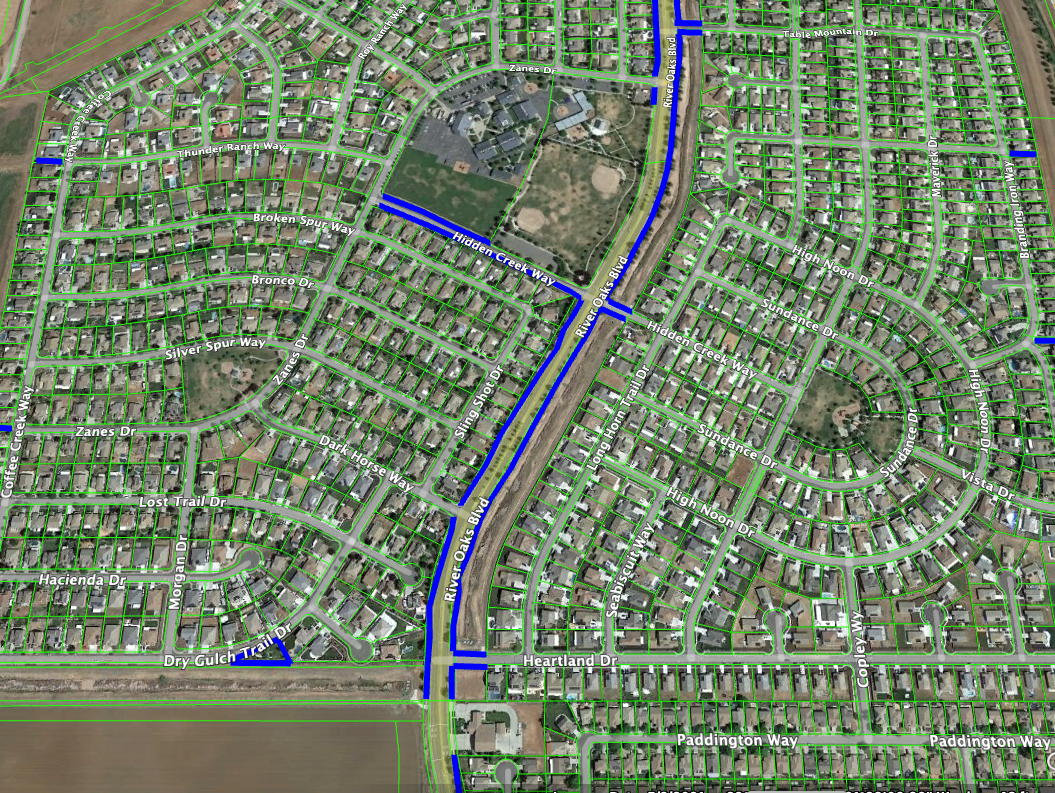
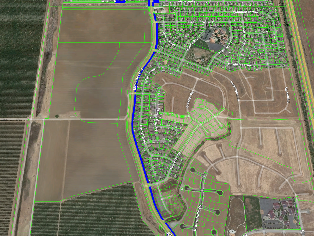
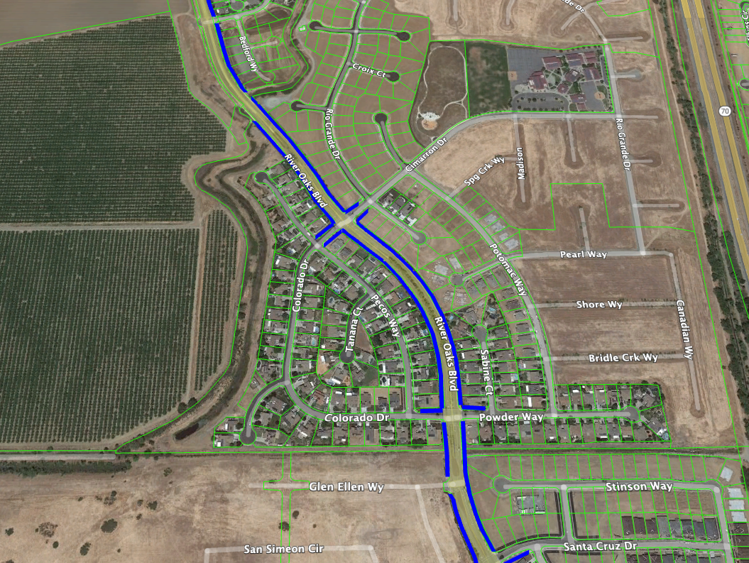
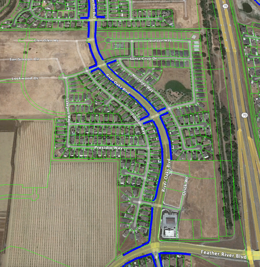
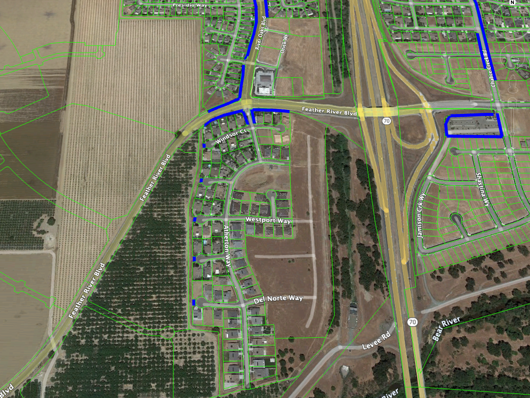
Central & Southern Plumas Lake
The blue lines on these map show where Yuba County (via Elite) is responsible to maintain landscaping. In general, it’s landscaped areas along River Oaks (excluding commercial parcels), select turn-offs from River Oaks, Plumas Lake Blvd west of River Oaks, Hidden Creek, county-owned property at the end of courts, and pass-thrus as indicated.
These seven maps cover the central and southern portions of Plumas Lake, on the west side of Hwy 70. To zoom in, right-click on an image and open it in another tab or window.
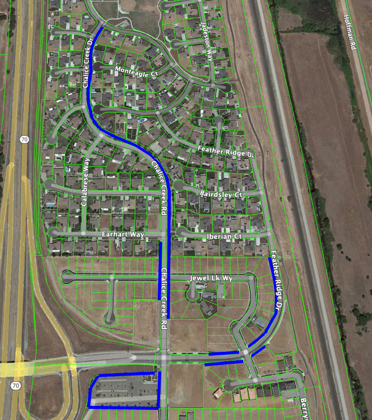
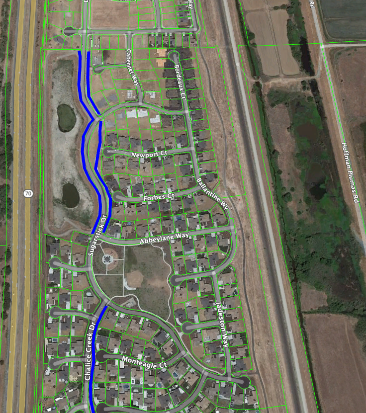
East Plumas Lake
The blue lines on these maps show where Yuba County (via Elite) is responsible to maintain landscaping. In general, it’s landscaped areas along the east side of Chalice Creek (with a small portion on the west side), portions of Feather Ridge, portions of Sugar Stick, Dusty Maiden (south of Arbozo), and the Park-&-Ride.
These two maps cover the portion of Plumas Lake east of Hwy 70. To zoom in, right-click on an image and open it in another tab or window.
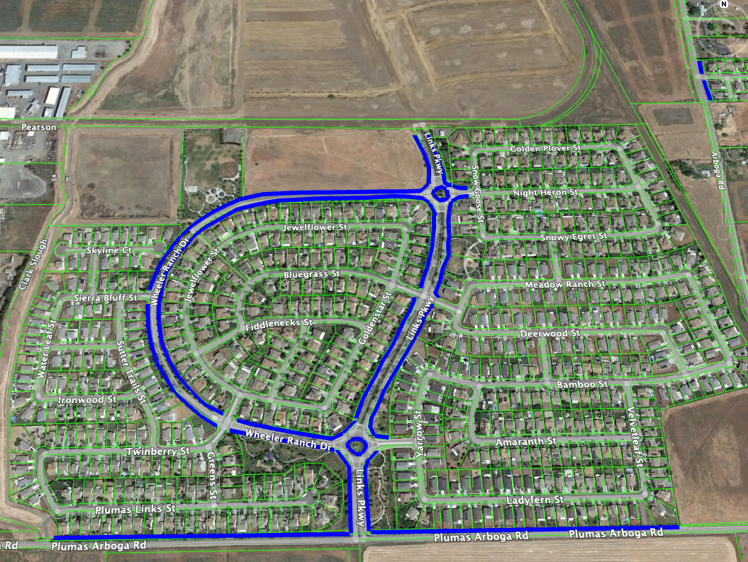
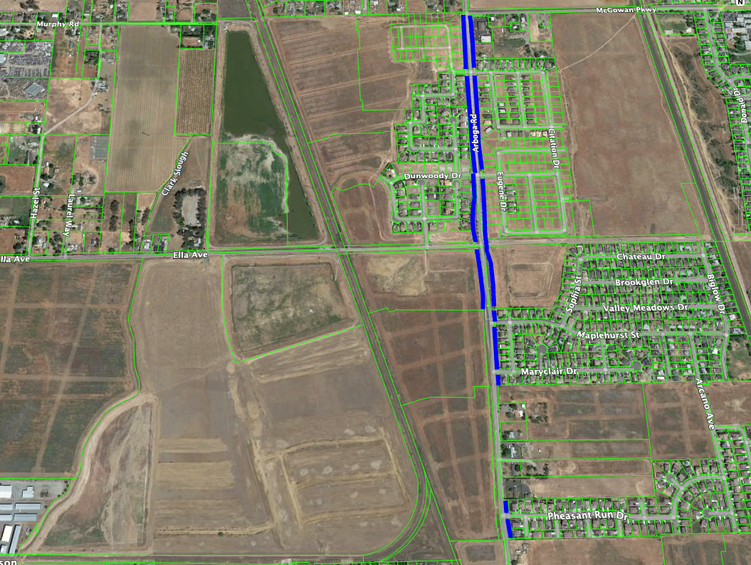
Arboga / North Plumas Lake
The blue lines on these maps show where Yuba County (via Elite) is responsible to maintain landscaping. In general, it’s landscaped areas along Plumas-Arboga Rd, Links Parkway, Wheeler Ranch Drive, and Arboga Rd.
These two maps cover Arboga/North Plumas Lake. To zoom in, right-click on an image and open it in another tab or window.
Exceptions
Anything not shown in blue on these maps is the responsibility of the property owner. This includes:
- The strip of landscaping between the sidewalk and the street (homeowner is responsible)
- Areas outside the fence on the side yards of corner lots (homeowner is responsible)
- Areas around mailboxes in front of homes (homeowner is responsible)
- Parks and Landscaped areas along sidewalks adjacent to Parks (OPUD is responsible)
- Schools (school district is responsible)
- Commercial Properties (the business is responsible)
- Unoccupied New Homes (builder is responsible)
There are some types of property in the community that are not regularly maintained but usually receive weed treatment once a year in the spring by the owner to reduce fire risk.
- Undeveloped Parcels (property owner is responsible)
- Bike Paths and Other Natural Areas (County is responsible)
- Levees, Drainage Canals, Drainage Basins (RD784 is responsible)
Who to Contact with Concerns?
If areas on the maps marked in blue are not being maintained or you have concerns about broken irrigation in those areas, you can contact Yuba County Public Works via this form to report the issue. Pictures and specific location information are beneficial.
If your neighbor isn’t pulling the weeds in their yard or mowing their lawn, chat with them to make sure they know it’s their responsibility. If the issue becomes a health and safety issue (like high fire risk), you can open a case with Yuba County Code Enforcement.
Finally, in the spring and early summer if you are concerned about fire risk on undeveloped parcels, you can reach out to Linda Fire who will send the property owner a notice to mitigate the issue, it the fire department will do it and bill them.
One comment
Comments are closed.